Hi everybody,
I prepared some material to present the ILMApilot-project’s activities. It’s in Finnish for now but there are a lot of pictures that are worth more than a thousand words 🙂
You can find it here: ILMApilot presentation materials
The project is organised in pilots, designed to provide satellite-based air quality products for different purposes and users. One of the pilots has been carried on in collaboration with FMI’s expert service department. We built our air quality maps over Azerbaijan (figure below), where an FMI’s team is helping to implement an air quality monitoring system, via one of their many international cooperation projects. You can read about the project in Finnish and English here: FIN ENG
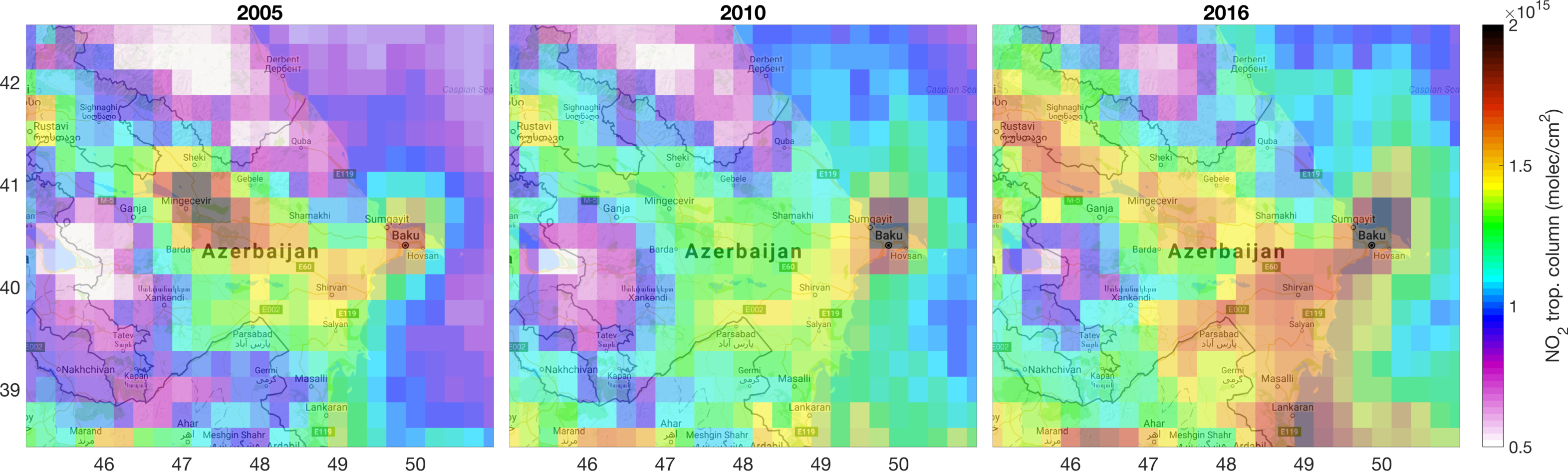
Our satellite-based NO2 maps were used as background information in an area where no other air quality measurements are available. The maps show for example increasing pollution levels over Baku (Azerbaijan’s capital and one of the most polluted cities in the world) from 2005 to 2016. The information about the NO2 distribution over the country provides also insights on where to place the ground-based air quality stations.
I hope to report more on future international collaborations very soon.
Iolanda