I’ve had not much time to write in this blog lately, so I’ll try to redeem myself before summer holidays with a few quick posts on my latest work.
Recently I’ve been involved in several applications of satellite-based observations for air pollution monitoring. I wrote about it a little bit in this article for FMI ATMOS article. The one that made me more proud was the collaboration with the Finnish cleantech company Outotec, that operates in the metal smelting sector. Their technological solutions help companies improve their sustainability by eliminating sulfur dioxide emissions (SO2) in the air. We used OMI SO2 observations to verify the emission reductions over several copper smelters all around the World.
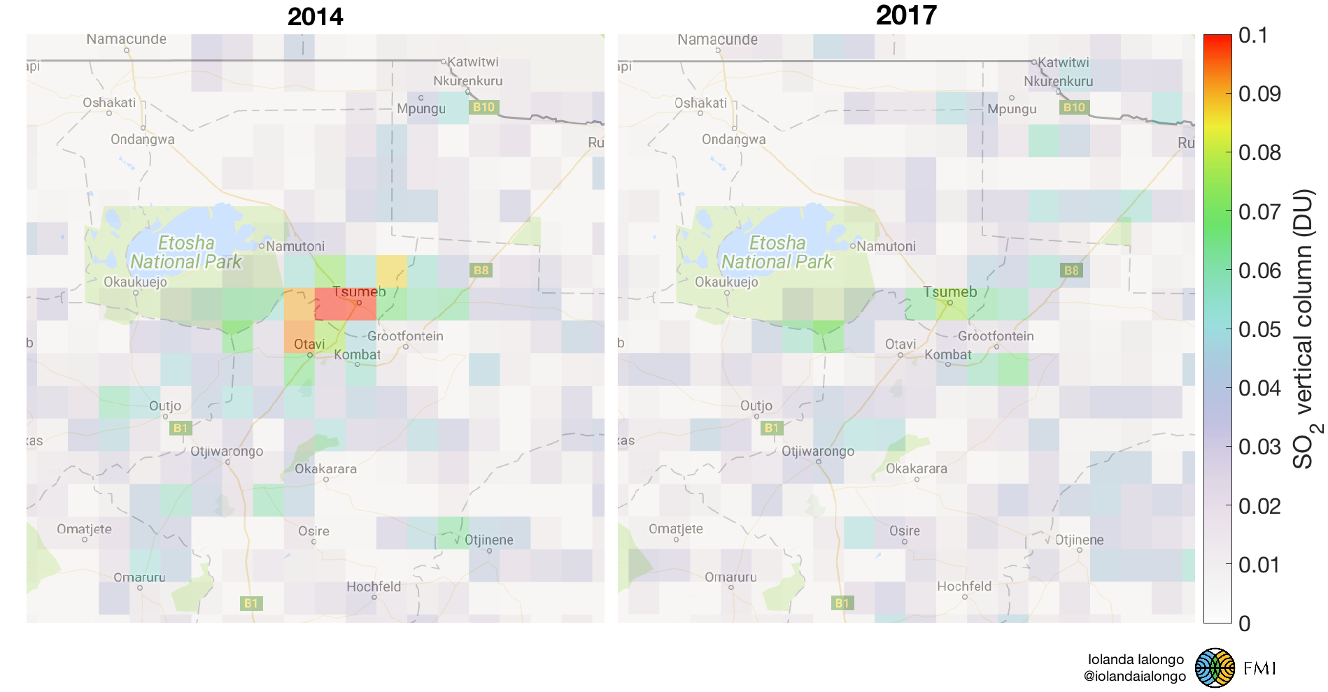
The first example was the copper smelter in Tsumeb (Namibia), where a sulfuric acid plant was implemented in 2015. The figure below shows how the SO2 concentrations in Tsumeb were reduced from 2014 to 2017, as an effect of the operative sulfuric acid plant. It was estimated that the SO2 emissions were reduced by more than 80%. These maps are based on OMI SO2 retrievals.

These results were featured in the Outotec sustainability report for 2017 and recognised also by the Millennium Technology Prize on social media. More cases are under study to support this and other companies in achieving their sustainability goals. I hope to publish a paper about these results soon.
More satellite-based applications for international cooperation projects
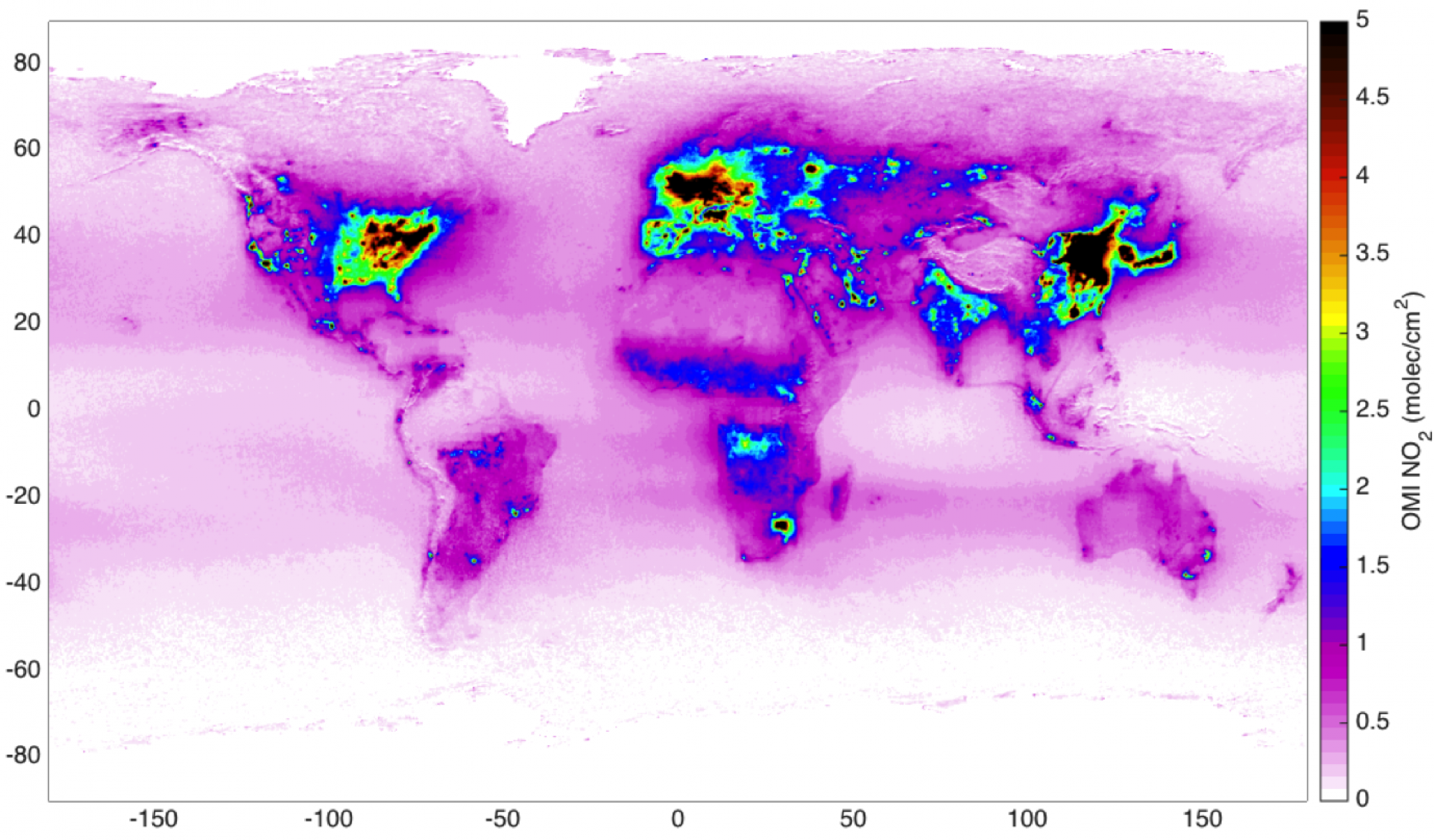
The added value of satellite observations is the strongest over areas where no other air quality data are available. This make them especially useful as background information in international cooperation projects. Finland is actually the World second country in term of budget for cooperation project in the field of meteorology and FMI is involved in many of those projects. Satellite data were used for example to evaluate the spatial distribution of NO2 and SO2 pollution in Ukraine and the changes related to the war against Russia and to environmental policies. Also, I prepared a training seminar for our collaborator in Azerbaijan to illustrate the potential of satellite data in monitoring air pollution in their country as well. The map below shows the annual mean NO2 levels in the troposphere as seen from OMI since 2005. In particular the area around Baku experienced a sensible increase in pollution, making it one of the most polluted cities in the World.

